
An Isle Of Skye Road Trip: Part 2 - West To Neist Point Lighthouse
SCOTLAND
19 May 2025
An Isle Of Skye Road Trip: 2 – West To Neist Point Lighthouse

Continuing our Isle of Skye road trip three-parter, we leave Part One’s circumnavigation of the Trotternish Peninsula and head west to the equally rugged Duirinish Peninsula and Neist Point.
It’s November. The weather is challenging, to say the least. But the crowds have gone, meaning we’re heavily outnumbered by the native sheep and Highland cattle. Our main concern is whether or not our 16-year-old Ford Focus will survive the brutal potholed roads.
Only one thing for it – turn the radio volume dial up to eleven, shift into top gear and head west. Only the radio doesn’t work. And dodging potholes becomes secondary to avoiding the sheep who, having realised that everyone has left, are now resorting to herding and gossiping in the middle of the road.
Disclosure: This page contains affiliate links, which means that if you ultimately make a purchase, we earn a small commission at no extra cost to you. And it helps to keep our content free!
Contents
WEST TO NEIST POINT
Click on the link to go straight there…
At the head of Loch Snizort Beag, just after the small crofting village of Kensaleyre, we turn right from the A87 onto a single-track road that connects with the A850 heading west. It’s a scenic diversion, albeit with the customary obstacle of stubbornly immobile sheep littering the tarmac.
Almost immediately after joining the A850, we take a right at Skeabost for a quick visit to St Columba’s Isle. Dating back to the 11th century, it’s the site of an ancient burial ground for former bishops. And, having been restored in recent years to something resembling its former glory, it features sculptured stones dispersed around a grassy islet on the River Snizort – including one depicting a knight in full armour.
Back on the A850, we continue west on what, by Skye standards, is a smooth, pothole-free two-laned expressway towards Edinbane. Indeed, as recent as just a few years ago this was just a poorly-surfaced single-track road – a sign of how increased tourist numbers have driven the authorities to ramp up the infrastructure spend.
(Just before Edinbane we pass the village of Flashader, where we spent two weeks housesitting in a former guesthouse. Overlooking the loch, we were responsible for twelve chickens and five ducks. Which would normally be quite straightforward. Only our chickens had infected legs and needed anti-fungal liquid administered with a toothbrush every third day. Cue happy memories of me on my knees in the mud trying to catch the chickens and a clearly upset cockerel from their coop, then holding them individually while Nicky gave their legs and feet the full pedicure treatment.
Pro tip: don’t even think about picking up a cockerel without holding its wings in place first. And yes, that’s as difficult and stressful as it sounds.

“Trust me, I’m a doctor…”
The Waternish Peninsula
Soon, a turning to the right directs us to the Waternish Peninsula. Crossing the stone fairy bridge (as we discovered, Skye has many fairy-somethings, be they glens, pools, bridges, towers or anything else you can pin on a map), we follow the winding single-track road to the pretty village of Stein.
Overlooking the icy-looking water of Loch Bay towards the cliffs opposite and Isay Island beyond, it’s notable for Skye’s oldest pub, The Stein Inn and the Loch Bay fine dining restaurant next door. Both have a fabulous view of the loch from their waterfront position. But the weather on this freezing November day dashes our plans to take advantage of it.
Undaunted, we continue along the road to the furthest point on the peninsula, where there’s a pleasant walk to a lighthouse at Waternish Point.
Over the centuries, the surrounding moorland has seen its fair share of bloody battles between the warring clans of MacLeod and MacDonald. Mainly because of the former wresting control of Skye from the latter during the 14th century. Indeed, there are memorials to past clashes scattered around the countryside. In particular, the notorious 16th century Battle of the Spoiling Dyke, one of the bloodiest in Highland clan history, and which almost wiped out the MacDonalds.
As Mackenzies, it feels like we’re trespassing on sacred land. But an icy blast of Waternish wind brings us back to reality, so we head back along Lochbay Road to the A850.
Have you considered house sitting?
Over the years we've saved thousands of pounds on accommodation costs by house sitting all over the world. If you’re new to the concept but want to give it a try, you’ll need to sign up for one or more specialist websites that connect homeowners with potential house sitters. The world’s largest platform is Trusted Housesitters, with tens of thousands of opportunities around the globe.
By creating a free account with them you can preview what housesits are currently on offer, filtered by country, region or city.
You can do that by following this link and choosing the “Find a house sit” tab. If you then decide to join as a member, you’ll also receive a 25% discount on your first year’s subscription.

Find out more
Dunvegan & Coral Beach
Continuing west, we’re now approaching the heart of MacLeod country, culminating in the dramatic Duirinish Peninsula. But, before then, we arrive at Dunvegan, situated at the head of the long sea loch of the same name. With its guest houses, restaurants and tourism infrastructure it’s a good option for staying overnight. Especially given its proximity to the famous Dunvegan Castle, just a mile along the coast road.
The Chiefs of the MacLeod Clan have called the castle “home” for more than 700 years. Which looks quite the status symbol given its beautiful towers and striking position overlooking the loch. However, the original 13th-century version was consigned to history after its mock-medieval makeover in 1840. Nevertheless, it’s one of Scotland’s most visited castles.
Particularly famous is the Fairy Tower, which holds the three great MacLeod treasures.
Pride of place goes to the Fairy Flag. According to legend, an early Clan chief married a woman from the fairy world and they had a child. Pressured by her fairy kin to return her to the fold, the couple had to separate (saying their reluctant goodbyes at Fairy Bridge in Waternish), only for her to return one night after hearing the cries of her sick child. She wrapped the baby in a fine cloth, which became known as the “Fairy Flag” bearing three magical qualities – 1) when spread on a bed it would grant children; 2) when hoisted at the castle it would entice herring into the loch; and 3) when it was waved in battle, victory would be ensured. Apparently, young clansmen in the armed forces even carried photos of the flag with them as a lucky charm during the Second World War.
The two other treasures are the Dunvegan Horn and the Dunvegan Cup, which you can read about here.
As luck would have it, the castle is closed on our visit (it’s only open from April to October). But we can still appreciate its wonderful setting between the loch and the wooded hillside from a number of viewpoints further along the road.
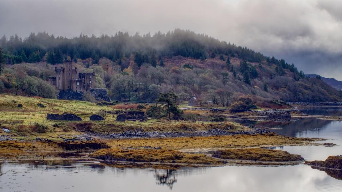
Dunvegan Castle from the road to Claigan
Indeed, the road to Claigan and its coral beaches is a stunner, with views across the loch to the Duirinish Peninsula, speckled with white croft houses peering out from the pinks, oranges and greens of the landscape. And, to our left, clouds hover the MacLeod Tables like smoke billowing from active volcanoes.
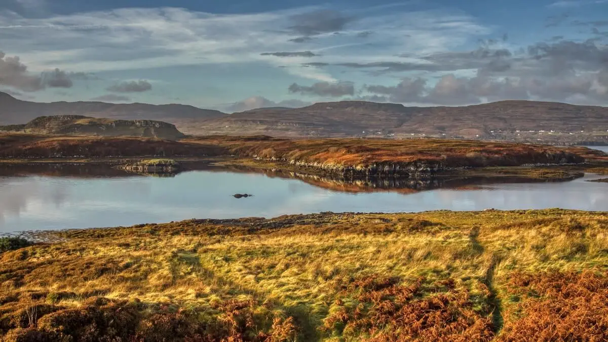
Dunvegan Loch

The MacLeod Tables
The end of the road dovetails into a car park for the short coastal trail to the “coral” beaches of Claigan. We’d heard much about the almost Caribbean-like sand. But, instead of finely ground coral, the sand here consists of maerl – or calcified local seaweed. And in truth, on a stormy November morning, it looks like it. Still, it’s a peaceful, windswept place to linger a while. And a short walk to the top of the hill behind the main beach provides some good views of the beaches and the islands to the west.
To be fair, it probably needs some summer sunshine to see it at its best. When, by all accounts, you’d need to arrive early to find a parking space because of the crowds descending on it.

Coral Beach
Colbost & Glendale
Returning to Dunvegan, we continue through the village on the A863 towards Sligachan. A mile outside the centre, a right-hand turn takes us onto the B884 at Lonmore and heads straight toward the MacLeod Tables.
We’re back in the land of single track lanes, with regular passing places and potholes big enough to devour an unsuspecting campervan. It all suddenly seems very remote as the road winds through flat marsh and peatland.
In fact peatlands, created through the combination of dying plants and waterlogged ground, cover almost 20% of Scotland. Due to the lack of oxygen, the plants fail to fully decompose and eventually form compact peat. As an alternative fuel to coal, it’s in plentiful supply. As we can see by the pallets of peat bricks in the fields beside the road.

Peat bricks near Colbost
We’ve now reached the opposite side of Loch Dunvegan and, as the road gradually rises, the unmistakeable towers of Dunvegan Castle reappear. This time peering above the marshy Colbost Islands in the foreground.
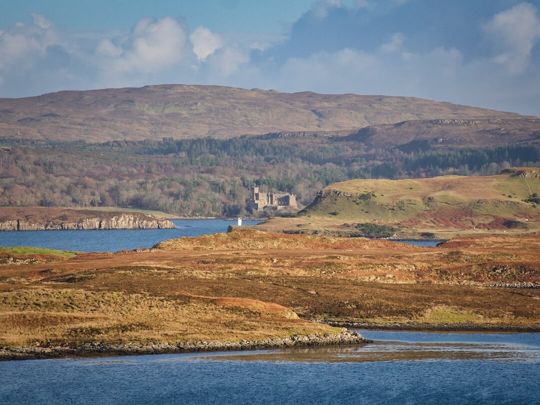
View of Dunvegan Castle from Colbost
We’ve arrived at Colbost, another crofting community whose claim to fame is its Michellin-starred restaurant, The Three Chimneys. Regularly cited as one of the best restaurants in Scotland, it’s a little too pricey for our meagre budget. A claim that’s reinforced when a helicopter lands beside the car park delivering a couple of lunchtime diners in style. Even if you’re not planning on dining there, take a look at their website as it includes some great drone footage of Skye.
Looking out over Loch Dunvegan it’s easy to picture the anchored steamers delivering supplies from Glasgow to Colbost well into the early 20th century. And the convoy of rowing boats dispatched to pick up essential goods – particularly the whisky stored in large stone jars.
(Colbost was also the site of our second Skye housesit – this time a three-week stint looking after 50-or-so chickens, ducks and geese. Unfortunately, it coincided with a mink on the loose hellbent on decimating our flock. And, not exactly endearing ourselves to the owners at The Three Chimneys, one of our geese was so spooked that it spent a night perched on the restaurant roof. Suffice to say, we soon developed rose-tinted memories of treating diseased chicken feet in Flashader).
Accommodation
If B&B accommodation in an elevated position overlooking Loch Dunvegan is something you’d be interested in we can thoroughly recommend Hazelbank B&B in Upper Colbost. Although we didn’t actually stay there, we got to know the owners during our time at the nearby housesit.
And, for us, the whisky tasting session with Mark & Pam in their dedicated tasting bar has reached legendary status.
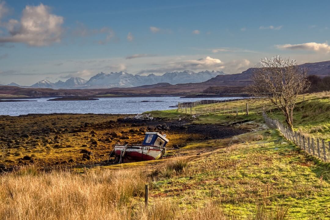
View of The Cuillin from Colbost
Beyond Colbost the road eventually turns inland and delivers a stretch with a set of potholes worthy of a special prize. We can only imagine how inexperienced campervan drivers manage to negotiate the narrow road without losing a wheel or two. Especially when it gets icy. Which is probably one of the reasons why much of it appears to have disintegrated.
We’re now heading down into a valley housing the crofting community of Glendale. It’s another scene of rolling hills dotted with white croft houses and leads to the coastal cliffs of northwest Skye.
If you’re unfamiliar with the concept of crofting, it’s a system of micro-scale farming and is a feature of Scotland’s North West Highlands and Islands. On Skye alone, there are over 2,000 crofts, helping to maintain a sustainable localised economy and representing an important part of the island’s culture.
Never miss a post - subscribe to our newsletter on Substack
Neist Point Lighthouse
After passing through Glendale we reach a turning on our left near Milovaig, which takes us over moorland to the Skye’s westernmost extremity at Neist Point.
Before we arrive at the end of the road, we pull off into a small parking area at Loch Mor. Ahead we can just make out a faint hiking trail to the 300-metre peak of Waterstein Head, the second-highest sea cliff in Scotland. Despite the wind and initial boggy conditions, we follow the trail as it climbs steeply above the loch.
From here onwards, the view across the moorland to Neist Point gets increasingly dramatic, accentuated by the rapid movement of shadow and light as blocks of clouds hurry across the sky like busy commuters at rush hour.
The unmistakable shape of Neist Point’s tiny peninsula, with its thorn-like cliff, stretches away from us into a calm, blue sea. A white dot near the end represents the famous lighthouse which appears on so many travel guide photographs of Skye – probably second only to the Old Man Of Storr.
We continue upwards, always near the edge, until we arrive at the summit. Welcomed by gusts of wind threatening to blow us off our feet (and quite possibly over the edge), we find a suitable boulder to hold on to and take in the astonishing view.
To our left, the huge cliffs continue around a bay, shrouded in a misty spray from the crashing waves below. Peering down over the edge, I’m overcome by a familiar tingling sensation, rendering my legs almost useless. Increasing my grip on the boulder, I turn around to face Neist Point directly ahead. As one of Skye’s biggest attractions, it draws crowds of campervans and tour buses. But, up here, it feels like we’ve discovered a remote, still-undiscovered part of the world.
It’s possible to continue walking beyond Waterstein Head and along the cliffs to Ramasaig. But those gusts of wind are only likely to get worse, we figure, so we take the safe option and head back down. Though you can rest assured we’ll return to do the full clifftop hike next time around.
More on the Waterstein Head trail
Distance: 4 km (2.5 miles) return Time: 2 hours Car Park: free Type: There and back Difficulty: Moderate Terrain: Moorland, boggy at the beginning, steep in parts and runs close to the cliff edge at times

View of Neist Point from the Waterstein Head trail

Near the summit
Back in the car, we complete the short trip to Neist Point, where the final section of road is widened to accommodate plenty of parking spaces – although these fill up quickly during the summer season.
To our left, we can see the mass of Waterstein Head, its massive vertigo-inducing cliffs looking even more dramatic from below. A short walk to the end of the road takes us down to a junction of sorts. A trail directly head drops steeply towards the lighthouse (which is still out of sight), while a boggy trail to our right leads to a vantage point beloved of landscape photographers and sunset lovers.
In front of us is a metal hoist, used back in the day to winch supplies up and down from a corresponding hoist near the lighthouse. The trail down – after a steep initial drop – is pretty level for much of the way and takes about 30 minutes. It feels a little underwhelming when compared to the Waterstein Head experience – a quick walk around the lighthouse (we can’t go inside) and headland surrounding it and we’re ready to head back up again.

Waterstein Head and the cliffs beyond, viewed from Neist Point
Much more interesting is the second trail to the vantage point along the cliffs. During the summer season, people flock here for sunset and to take one of Skye’s most iconic photographs. From here the lighthouse appears at the very end of the finger of headland, seemingly pointing toward the sun as it falls beneath the watery horizon.
On our November visit the sun is already setting by late afternoon and we begin to understand what all the fuss is about. Only at this time of the year, there’s just one lonely photographer to keep us company. To the right of the lighthouse a thin band of cloud hovers over the island of Benbecula, its mountainous profile silhouetted under an orange sky.
Finally, the sun disappears from view and a final gust of wind confirms that it’s time for us to depart.
Having travelled to Skye’s northern and western extremities, we’re ready to head south to sample some of the island’s other delights. The weather forecast suggests plenty of sunshine and freezing temperatures. Just the right combination to explore the lower sections of the famous Cuillin Hills.
And, of course, to sample some of Skye’s smoky single-malt whisky
Coming next in Part Three.

Neist Point at sunset
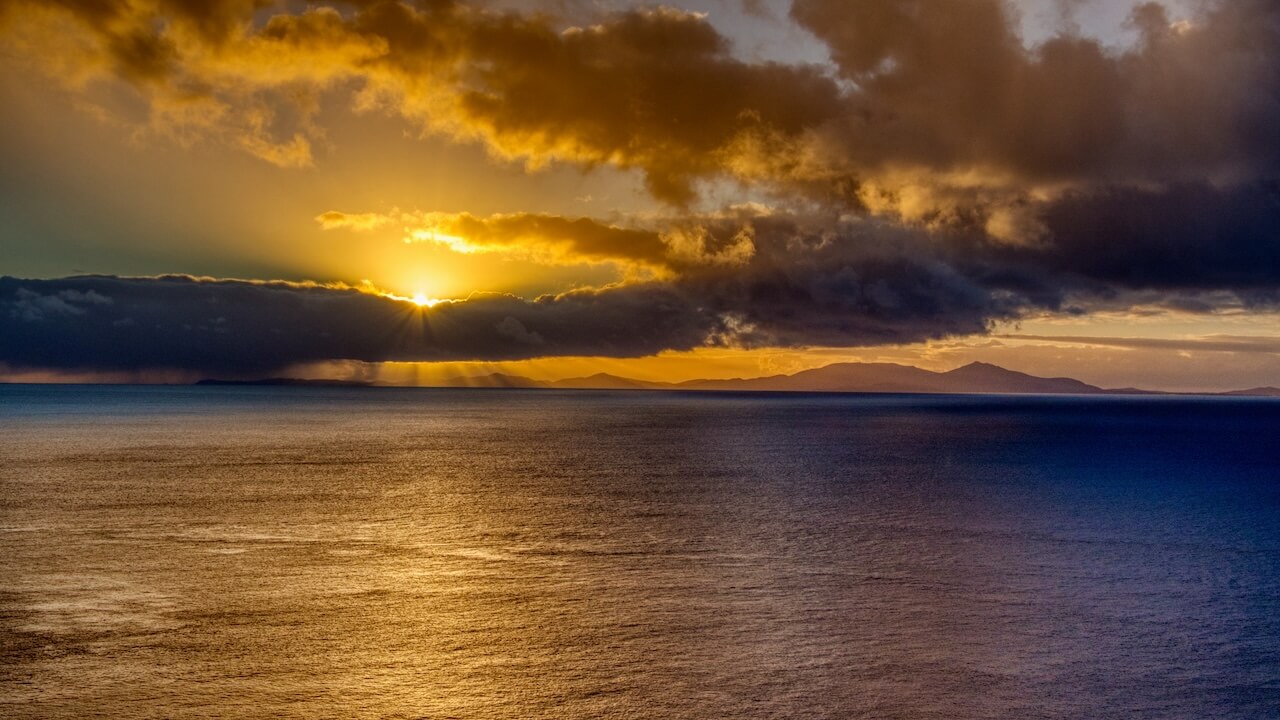
Benbecula and the Outer Hebrides bathed in the light of a setting sun
Neist Point
Waterstein Head
Glendale
Colbost
Dunvegan
Dunvegan Castle
Claigan Coral Beach
Stein
Waternish Point
Edinbane
MacLeod's Table North
St Columba's Isle
What did you think? Have you been on an Isle of Skye road trip? Or perhaps you’re visited Neist Point Lighthouse? Either way, we’d love to hear from you, so please add your comments below.

Thanks for reading
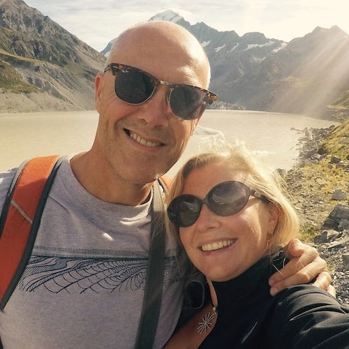
Hi, we're Ian and Nicky, an English couple on a voyage of discovery around the world, and this blog is designed to reflect what we see, think and do. Actually, we'd like to think it also provides information, entertainment and inspiration for other “mature” travellers, too. So please feel free to pour yourself a glass of something suitably chilled and take a look around.
We have arrived on Isle of Skye, googling what to see, found main points of interest, found your part 1 and 2, very well narrated and photos, we think we will follow the routes at some point Thank you 🙂
Our pleasure, Diane – hope you found them useful. Enjoy your time on Skye!