Hiking Cerro de la Sirena: Guanajuato's Pre-Breakfast Secret
MEXICO
11 January 2024
Hiking Cerro de la Sirena: One Of The Best Things To Do In Guanajuato

As one of our favourite places in Mexico, Guanajuato is a city that feels like home to us. Situated four hours by road northwest of Mexico City, it’s popular with domestic tourists but receives relatively few international visitors. So, although it’s hardly off the radar altogether, we like to think of it as our little secret.
Indeed, we spent two glorious months living in the city. Enough time to get a little under its skin in addition to experiencing its many attractions. More on that in another post very soon.
For now, we’d like to share with you what we believe to be one of the best things to do in Guanajuato – if you don’t mind a bit of exercise before your breakfast. OK, for “a bit of exercise” read “a steep climb of 350 metres (1150 feet) from the centre of town to the top of a hillside and back”.
Believe us, it’ll help you blow away the cobwebs, strengthen those calf muscles and set you on the way for an exhilarating day in the city. And, by starting between 8 and 9 am you’ll be avoiding the heat of the day and returning in time for a fabulous mid-morning breakfast.
Sound good?
Here’s how Ian did it…

View of Cerro de la Sirena from El Pipila monument
Table of Contents
Click on the link to go straight there…
HIKING CERRO DE LA SIRENA: ONE OF THE BEST THINGS TO DO IN GUANAJUATO
About Cerro de la Sirena Guanajuato
We hadn’t heard about Cerro de la Sirena before we arrived at our apartment, just a stone’s throw from Guanajuato’s famous El Pipila monument. They say El Pipila has the best viewpoint of the city. And, certainly, the view from our terrace is to die for.
Pastel-coloured buildings sprawl along the valley below and up the hillsides to the left, right and in front of us. Pink, red and yellow churches, together with a white-stone gothic University, cram around a historic centre. And, towards the mountains in the distance, remnants of the city’s mining heritage stand proud like abandoned fortresses.
But, directly opposite, a parched hillside stretches clear of the urban development to reveal a small patchwork of scratch marks. And, at its peak, a white cross radiates against a blue, cloudless sky. We’re looking over to Cerro de la Sirena (“Hill of the Mermaid”), and Ian’s trying to work out if those scratch marks are footpaths that will lead him to the summit.
Also known as Cerro de la Crucita (“Hill of the Cross”), its peak is at an altitude of 2,404 metres (7,890 feet). And those scratches are indeed footpaths. Interest piqued, Ian decides he’ll forego his normal early morning coffee and breakfast to take on the challenge the very next day.

Our recommended route to and from Cerro de la Sirena
Setting out on foot
It’s 8.30 am and the morning sun illuminates El Pipila behind me. Down below, the city remains caught in the shadow of the surrounding hillsides. I scamper across the stone steps and along the cobbled alleyways that lead steeply from our apartment, down to Guanajuato’s historic centre.
City life is slowly jumping into gear. The earthy smell of griddled corn tortillas and the rich aroma of freshly brewed coffee fight for my attention. I pass the tree-lined Jardín de la Unión. Scene of a nightly rapturous evening of mariachi music and wandering minstrels, it’s relatively empty now.
I continue through colourful Plaza de la Paz and up a side street to the University of Guanajuato – a gothic white stone building that contrasts sharply with the dominant reds, pinks and yellows of everything else around.
To the left of its 133 entrance steps, a steep and narrow cobblestoned road (de Guadaloupe) curls behind it to begin the long ascent to La Sirena. Along the way, I pass the deep pink Santuaro de Guadeloupe, another of the city’s most distinctive landmarks.
And then I arrive at Guanajuato’s Panorámica, a twisting road that snakes around the hillsides surrounding the city. A quick left and then a quick right takes me up another cobblestoned road, which turns into a gentrified street of upmarket houses and block paving.
Typical of how the expansion in Guanajuato is taking root, these expensive-looking dwellings are the last ones up the hillside before the wilderness takes over. As I find out when I pass the last house and the block paving morphs into a stony dirt track.

Passing Jardin de la Union
Interested in housesitting while you travel?
We were able to spend two months housesitting in Mexico. If you’re interested in doing the same, you might want to consider joining Trusted Housesitters – the world’s largest housesitting platform. And you can do so with a special 25% discount off your first year’s subscription through our link below.
Route 1 to the summit
From my vantage point across the valley at El Pipila, I’ve established that “base camp” for the most direct route to the summit is an abandoned white concrete hut. To get there from here I have two choices – continue on the dirt track as it bends around a hairpin to my right, or take the “footpath” to the left. I opt for the latter and find myself climbing over a combination of rock, loose stones and dirt track.
The route becomes increasingly steep until it levels out and meets a more established footpath to my right. Passing cactii covered in cobwebs the footpath traverses the hillside until I reach the abandoned hut. I’m 35 minutes into my hike and the hubbub of Guanajuato already feels like a fading memory. Meanwhile, high above me, I can just make out a large black bird perched on the white cross at La Sirena’s summit.

View of the summit from the abandoned hut
To join it, I’ve got another couple of choices. Continue on the established footpath and traverse some more hillside before ascending to the summit via a rocky path on the other side of the hill (ie the long way around) – or head straight up the bare rock in front of me (“Route 1”, as we like to call it). I decide that the pull of breakfast deserves some urgency on my part so I take a deep breath and opt for Route 1.
For the next 20 minutes or so, it’s a relentlessly steep climb. Much of it over bare, volcanic rock. By now the sun is warming my back as it beams across the valley. I take regular breaks to catch my breath, turning to face the differing views of Guanajuato. A hastily painted white arrow on the bare rock reminds me (if I needed it) of the direction I should be following.

The volcanic rock is easier to walk on than I expected. Even at its steepest, the grip is good and I’m able to propel myself upwards without slipping. I reach the end of the bare rock and return to a more defined footpath. After such a tiring section, my breathing is much heavier. But the cross is now just above me and so I press on to the switchback and final grassy footpath to the summit.

The view from the final section of footpath
At the summit
I arrive at the cross 60 minutes after leaving the apartment across the valley. Leg-weary, I take a seat on the cross’s pedestal, unpack my litre bottle of water and drink in the amazing view.
The whole of Guanajuato is laid out in front of me like a giant 3D map. Iconic landmarks such as the Mercado Hidalgo and Alhoniga de Granaditas (birthplace of the Mexican Revolution) are easy to pick out. But, dominating it all, the red and yellow dome of Basilica Colegiata de Nuestra Señora de Guanajuato and the marble white of the University.
To the right, an arterial road threads upwards toward the old silver mines and onwards to the historic town of Delores Hidalgo. To the left are the distinctive angular features of Cerro la Bufa. And, in the background, beyond the urban landscape, distant mountains are shrouded in haze.
It’s a time to rest aching muscles. To appreciate the sheer beauty of the place. And, at the half-way point of the walk, an opportunity to decide on whether I’ll be going for the tacos, enchiladas or gorditas for breakfast.
So, after 15 minutes or so, with an empty water bottle and hunger pangs turned up to eleven, it’s time to start walking again and head back down. Only this time I’ll be taking the slower route.

That white cross…

…and a moment to rest those feet
But, before leaving, I take a short walk away from the cross to appreciate the mountainous view behind me. It’s a reminder of the rugged landscape in this part of Mexico. The green and sandy-brown monotony of the mountains is only broken by the electric blue of Presa da Mata, a reservoir just a couple of kilometres north of where I’m standing.

The blue Presa da Mata cuts through the mountains
Onwards to Cerro de las Ranas
Once again, there are two routes away from the summit. The designated route skirts the rear of the hillside and connects with the Panorámica near Presa da Mata. I decide to go slightly off-piste and take the less-marked route across the slabs of rock near the cliff edge. Although it’s not one I’d be happy to do when the light is fading. Especially as I have to cross two open crevasses.
Eventually, I connect with the main route and continue down the loose rock-heavy footpath until I reach a crossroads of sorts. Turning right here would eventually lead me back to the abandoned hut I passed earlier. Instead, I head straight down and back up another hillside to Cerro de las Ranas (“Hill of the Frogs”).
There’s a much simpler cross to mark the summit this time, but the view looks almost vertically down on Guanajuato. And, away to the left, a much clearer view of the foothills of Cerro de la Bufa.

View of Guanajuato from Cerro de las Ranas
Back down through the narrow streets
I scamper back down the hillside and reconnect with the footpath that continues on to Guanajuato. The white cross of La Sirena is now opposite me (to my right) as I pass through a field of cacti. And then I realise I’ve arrived back in civilisation as the unmistakable screech of a circular saw breaks the silence.
Eventually, I drop down to the Panorámica once again and follow its path as it circles the upper outskirts of the city. A detour off to the right takes me through a warren of steep, narrow cobbled streets that are so emblematic of Guanajuato life. Crumbling walls are masked by pastel shades of paint. And sets of uneven stone steps rise and plummet between the corresponding streets and alleyways.
Thankfully, the only direction I need are simply to keep heading downwards. Which I do with renewed vigour as the prospect of breakfast grows nearer.

And, finally…breakfast!
And finally, I arrive at de la Taza, a side street off de Gallitos (the main route into Plaza de Baratillo). Choice #1 for breakfast is here. Vamos con Lalo is run by three guys who honed their skills in the high-end restaurants of San Miguel de Allende. With just a few tables and chairs that spill out onto the street and surrounded by mural art, the place is as inviting as it gets. And the stylistic breakfast food is a joy. Go for the house chilaquiles (homemade tortilla chips smothered in cheese, chilli sauce, cream and chicken).
Continuing along de Gallitos, and just before Plazuela de Baratillo, I arrive at a street stall surrounded by a dozen or so hungry customers gorging on quesadillas and tacos. Something of a Guanajuato institution, Gorditas “Las Güeras” is a simple stall that specialises in gorditas (thick, griddled tortilla pockets with various stuffings). Our favourite is the gordita filled with pork in pasilla chilli sauce.

Gorditas “La Güeras”
Just around the corner, on the plaza itself, a small hatch leading from Nota Negra Bar sells (amongst other healthy fruit drinks) pints of jugo verde – a green smoothie made from blending limes, cucumber, nopale (cactus), parsley, spinach, mint and orange (or pineapple). Honestly, it’s as refreshing as anything we’ve ever tasted and is great after a hike.
But, on this occasion, I decide to take my usual table at my favourite Guanajuato breakfast eatery, Los Huacales. With a Mexican breakfast / brunch menu to die for, I could honestly eat here morning, noon and night. So, armed with a complimentary bowl of warm homemade tortilla chips and a selection of dips, I scour the extensive menu for something that’s going to satisfy my raging hunger and obsessive desire for lots of spice.
This time I plump for the chile relano (whole deep-fried chile stuffed with cheese and picadillo, and served with spicy tomato sauce, rice and black beans).
But I will return with alarming regularity to test the rest of the menu over the ensuing weeks.

Los Huacales, just off Plazuela de Baratillo
Final thoughts
This walk certainly won’t be for everyone. It’s a tough old hour-long climb at a reasonable pace at high altitude. So it’s guaranteed to get your heart pumping. But, for our money, it’s fully worth the effort as the lovely views of Guanajuato and its natural surroundings change all the time. And the summit provides an unrivalled view of the city.
We’d recommend doing it in the morning before the sun gets too high in the sky – there’s no shade once you hit the trail proper. Or you could do it just before sunset, making sure you return to a lower level before it gets dark.
And, unlike on La Bufa, you’re likely to have the trail to yourself rather than share it with groups of guided hikers.
But, for Ian, those dozen-or-so early morning walks to La Sirena, followed by breakfast in Plazuela de Baratillo, are amongst the biggest highlights of our extended stay in Mexico.

FAQs
When is the best time of day to hike Cerro de la Sirena?
Try to avoid the main heat of the day bewteen 11 am and 4 pm as there’s little or no protection from the sun – and the sun will be directly above or opposite you in the afternoon. Take our advice and go before breakfast and just before sunset.
Is the route safe?
The footpath can be quite uneven at times and some of the steeper sections have loose rocks to negotiate. The bare rock face shouldn’t hold any fears as long as you’re fit enough to push yourself upwards.
In terms of security, there have been reports of muggings on the Cerro la Bufa trail in the past – but not on Cerro de la Sirena. We didn’t come across any issues on our dozen or so visits. However be prepared to be on your own on the hillside.
Is hiking Cerro de la Sirena worth doing?
Absolutely, yes! In fact, we’d say if you only have time for one hike in Guanjuato, then this is the one to do.
What should I wear on the hike?
Things to bear in mind are that you’ll be walking over loose rubble and bare rock at times. And you’ll be passing through fields of cactus. So take decent walking shoes or boots.
If you decide to do it before breakfast you might need to wear a warm layer until you get above the urban section. At that point the sun will be shining on you and you’ll probably want to lighten the load.
Definitely wear plenty of sunscreen and take at least a litre of water.
How long does the route take?
From Jardin de la Union it took Ian approximately 50 minutes to get to the cross at the summit, following the most direct route, as described. But that was walking at a decent pace and not stopping for photographs and rests. Allow at least another 20-30 minutes if you’re planning on a more leisurely pace.
If you decide to take the longer route around, you can add another 20 minutes again.
Coming down via Cerro de las Ranas will take another 45 minutes to an hour.
Any other questions?
If there’s anything you’d like to ask about Cerro de la Sirena that we haven’t covered here, there are a few ways to get in touch with us.
Firstly, you can simply ask your question in the Comments section below. You can also get in touch using our contact form. Or, if you’d like to join our community on Facebook, you can ask directly there.
Either way, we’ll do our best to get straight back to you.
What did you think? Do you have any recommendations on hiking Cerro de la Sirena? Or perhaps you’re planning to go there in the near future? Either way, we’d love to hear from you so please add your comments below.

Visit our Etsy store for a wide selection of our photographs


PIN IT, SHARE IT

MORE ON THE AMERICAS


THANKS FOR READING
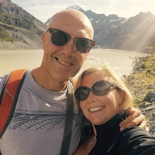
Hi, we're Ian and Nicky, an English couple on a voyage of discovery around the world, and this blog is designed to reflect what we see, think and do. Actually, we'd like to think it also provides information, entertainment and inspiration for other “mature” travellers, too. So please feel free to pour yourself a glass of something suitably chilled and take a look around.
0 Comments